
NGAMO-SIKUMI REDD+ PILOT PROJECT
by
I) OVERVIEW
The Government of Zimbabwe carried out the Hwange Sanyati Biodiversity Corridor (HSBC) Project with the assistance of the Global Environment Facility (GEF) through the World Bank over a five-year period, which started in January 2015. The project covers an area of 5.7 million ha in the northwestern part of the country. Its overall objective is “to develop land use and resource management capacity of managers and communities in the Hwange Sanyati Biological Corridor of Zimbabwe” and has the following components: Improving the management of protected areas and their buffer zones; improving forest and land management; and facilitating corridor sustainability.
One of the HSBC project components is to improve forestry and land management. The forestry component supports improved forest and wildlife management as well as REDD+ activities as a tool for good forest stewardship in Zimbabwe (World Bank 2014). The HSBC project is undertaking a REDD+ pilot project in Ngamo and Sikumi gazetted forests and surrounding communities. These forests are found in northwestern Zimbabwe and cover a combined area of 157,300 hectares.The REDD+ pilot project aims to build national capacity on Reducing Emissions from Deforestation and forest Degradation (REDD) in the country through local efforts to develop REDD activities alongside the related environmental and social benefits.

- FIRE MANAGEMENT
Pre-suppression fire management activities (opening of fire lines and grading of fire guards) are carried out on a yearly basis; with an average of 650 km being the target every year. Firefighting trainings are also constantly being conducted for communities buffering the carbon accounting area. To date three community fire brigades have been created in wards buffering Ngamo and Sikumi forests. The communities are from wards 15, 16, 17 and 18 (Hwange district); ward 4 (Tsholotsho district) and Sotani ward 26 –(Lupane district). These fire management efforts, including the sustained campaigns from Forest Officers, have resulted in reduction in fire incidences within the project area.


Download the Fire Management Plan Document
FIRE MANAGEMENT PLAN NGAMO FOREST 2017 (1)
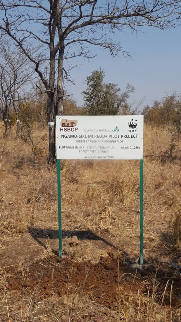
- BIOMASS ASSESSMENT
A biomass assessment survey was carried out to quantify the carbon stock baseline for the project area. Using both remotely sensed data and in-situ field based measurements two carbon pools were measured i.e the above ground woody biomass carbon pool and the deadwood carbon pool. A total of 228 plots were established across all vegetation cover classes in both forests. The following parameters were then recorded per plot: tree height, dbh and tree health status. 52 different tree species were recorded in Ngamo whilst 62 tree species were recorded in Sikumi with Baikiaea plurijuga being dominant in both forests. Sikumi had an average above ground carbon stock of 19.4 tonnes per ha whilst Ngamo had 18.2 tonnes per ha.

Download the Biomass Assessment Report and Forestry Inventory Manual Below:
BIOMASS ASSESSMENT REPORT-HSBCP_V1.1
- COMMUNITY ENGAGEMENT

- ANTI-POACHING
- GALLERY
Recommended Posts
THE NATIONAL FOREST POLICY
April 26, 2024
Carbon Trading in Zimbabwe
October 03, 2023
Tree of the Year 2023
September 27, 2023