
The Zambezi Valley Biodiversity Project (ZVBP)
by admin
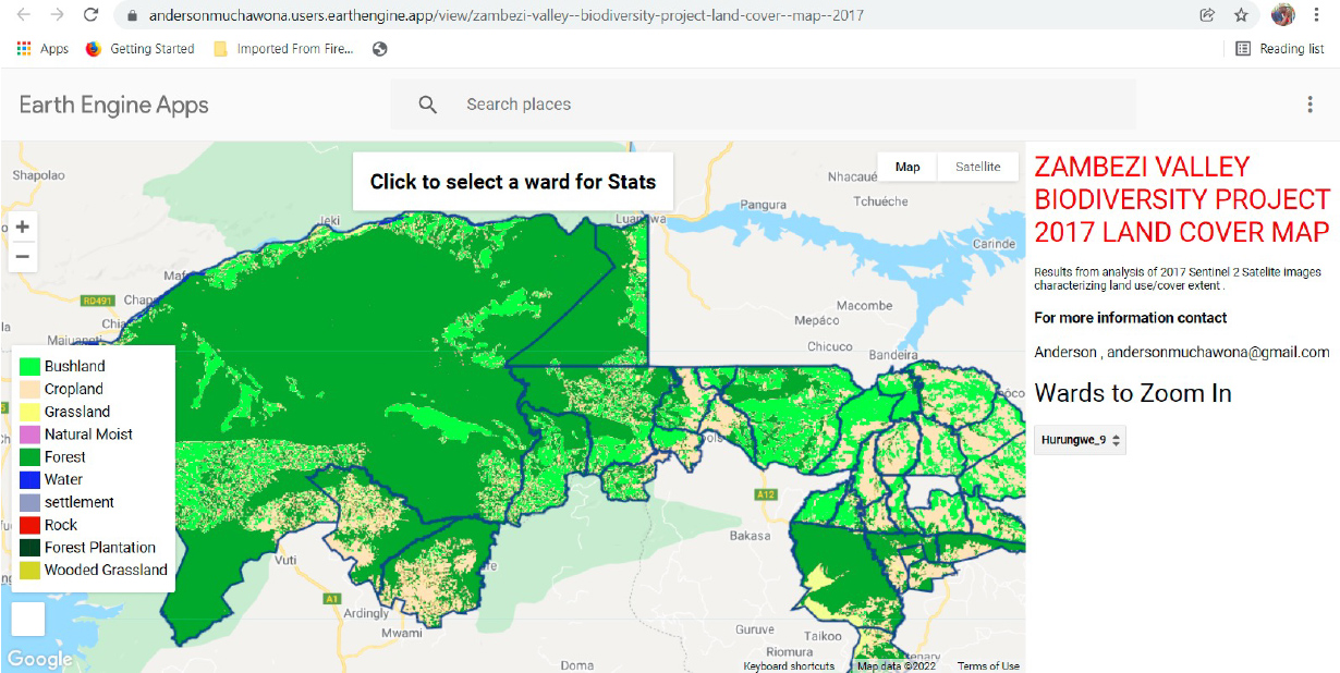
Land cover Map for the project area
The Forestry Commission Mapping and inventory unit developed a land cover map for the project area. The map was developed from Sentinel 2 satellite imagery for 2017.The processing was carried out using Google Earth Engine platform.

Geospatial tool
For easy data sharing , a Google earth engine was developed that allows the user to view the land cover and generate the statistics at ward level.
The link to the app :
https://andersonmuchawona.users.earthengine.app/view/zambezi-valley–biodiversity-project-land-cover–map–2017
Permanent Sample Plots (PSPs)
Permanent Sample Plots (PSPs) provide a unique long-term re-measurement dataset that is used to develop growth-and-yield models that support timber supply analyses and sustainable forest management decisions. In 2020 and 2021 Forestry Commission with the help of UNDP established PSPs in Hurungwe, Mbire and Muzarabani. Information and data from PSPs shall assist the organisation in monitoring forest resources in Zimbabwe.
Data collection in Mbire

Recommended Posts
THE NATIONAL FOREST POLICY
April 26, 2024
Carbon Trading in Zimbabwe
October 03, 2023
Tree of the Year 2023
September 27, 2023